US Map / Time Zones / Central Time
Central Time Zone Map
Twenty states have Central Time somewhere inside them, and ten of those keep another zone as well — more splits than any other US zone.
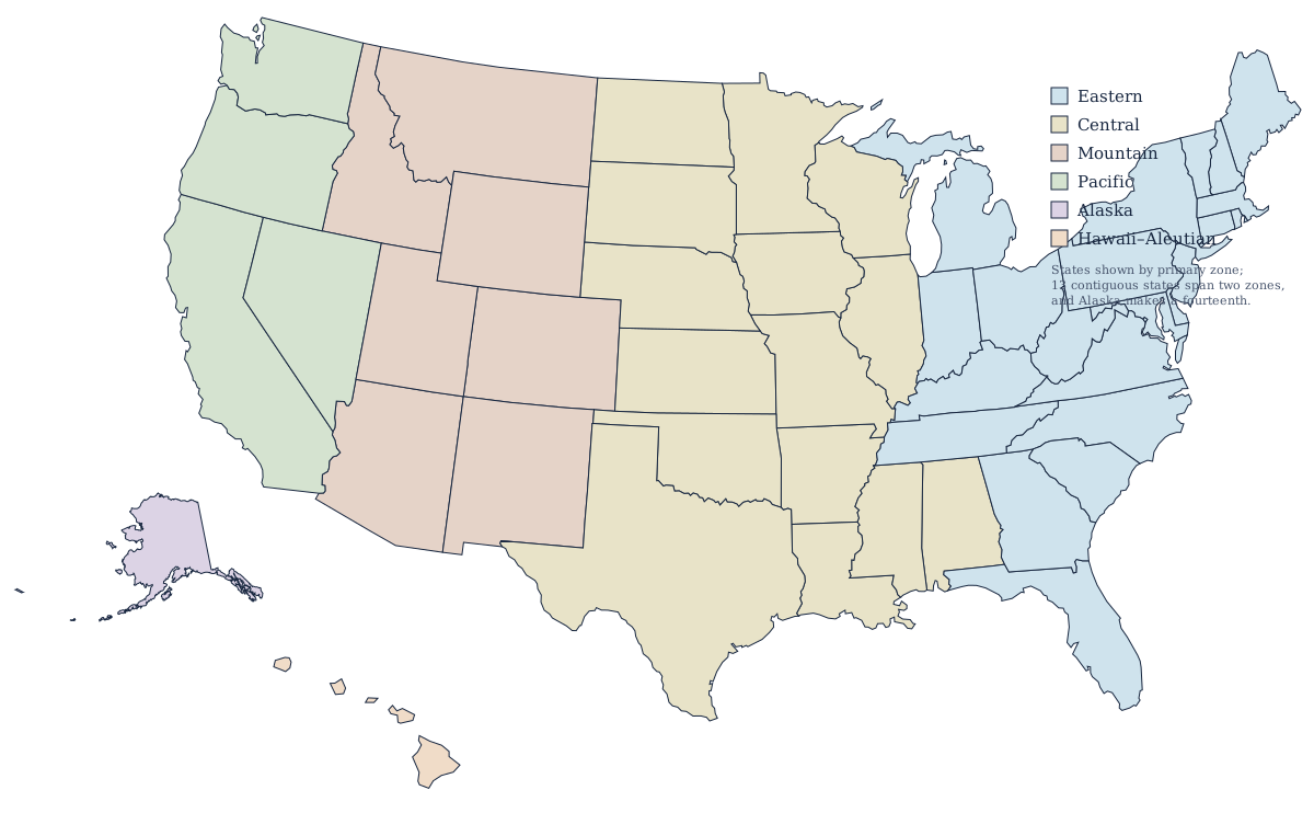
Ten states in, ten more half in
Central Time runs unbroken from the Gulf coast at Brownsville, Texas, to the Manitoba border, roughly 1,600 miles north to south. Ten states lie wholly inside it and ten more are split with a neighboring zone — more divided states than any other US zone, and the reason a Central Time answer so often needs a county attached to it. Thirteen states in the contiguous US are cut by a zone line altogether, plus Alaska out in the Aleutians, and Central accounts for ten of the thirteen.
Those ten cover the Gulf coast, the lower Mississippi valley, the corn belt, and the eastern plains. Texas, Kansas, Nebraska, North Dakota, and South Dakota are mostly Central but lose their western ends to Mountain Time, and Florida, Indiana, Kentucky, Michigan, and Tennessee contribute counties from the Eastern side.
The splits, county by county
On the plains the Central–Mountain line is essentially the boundary of ranch country. In Kansas only the four westernmost counties — Sherman, Wallace, Greeley, and Hamilton — are on Mountain Time. Nebraska gives up its panhandle, including Scottsbluff and Sidney. South Dakota splits close to the Missouri River, putting Rapid City and the Black Hills on Mountain Time while Pierre and Sioux Falls stay Central, and North Dakota does the same in its southwestern corner. In Texas only two counties, El Paso and Hudspeth, are Mountain, which is why El Paso runs an hour behind Dallas despite being in the same state.
On the eastern side, Florida's panhandle west of the Apalachicola River is Central; Indiana contributes six counties near Chicago and six near Evansville; Kentucky gives up its western half and Tennessee everything west of the Cumberland Plateau, which puts Nashville, Memphis, Bowling Green, and Paducah on Central time; and four counties in Michigan's western Upper Peninsula stay Central to match Wisconsin.
UTC offset: CST and CDT
| Standard time (CST) | UTC−6, one hour behind Eastern |
| Daylight time (CDT) | UTC−5 |
| Clocks forward | 2:00 a.m. on the second Sunday in March |
| Clocks back | 2:00 a.m. on the first Sunday in November |
| States wholly in the zone | 10 |
| States partly in the zone | Florida, Indiana, Kansas, Kentucky, Michigan, Nebraska, North Dakota, South Dakota, Tennessee, Texas |
The clocks move on the same two Sundays here as in every other state that keeps daylight saving — the schedule and its history are set out on the Eastern zone page — and no part of the Central zone opts out. The offset worth watching is the overlap: Central Daylight Time is UTC−5, which is also Eastern Standard Time in winter. A timestamp recorded only as UTC−5 is therefore ambiguous unless you know the month, and the same trap repeats one zone west, where Mountain Daylight Time and Central Standard Time are both UTC−6.
Cities on Central Time
Chicago is the largest, followed by Houston, San Antonio, Dallas, Austin, Fort Worth, Oklahoma City, Nashville, Memphis, Milwaukee, Kansas City, Omaha, New Orleans, and Minneapolis. That list spans the Midwest and the South almost equally.
Adjacent zones
Eastward is Eastern Time and westward is Mountain Time; beyond those are Pacific, Alaska, and Hawaii–Aleutian. The US time zones map shows all six together.