Kansas Map
The geographic center of the contiguous 48 states stands in a Kansas pasture. Capital: Topeka. Largest city: Wichita. Abbreviation: KS.
Kansas at a glance
| Capital | Topeka |
| Largest city | Wichita |
| Abbreviation | KS |
| Population | 2,970,606 (2024 Census estimate) |
| Land area | 81,759 sq mi |
| Region | Midwest (West North Central division) |
| Time zone | Central Time in all but the four westernmost counties — Sherman, Wallace, Greeley and Hamilton — which keep Mountain Time |
| County count | 105 counties |
| Statehood | 1861 (34th state) |
| Borders | Nebraska, Missouri, Oklahoma and Colorado; three of the four lines are straight survey boundaries |
Major cities
Two-thirds of Kansans live in the eastern third of the state. Wichita, 400,991 in 2024, sits on the Arkansas River and is the only Kansas city among the hundred largest in the country. The larger population block is the Kansas side of the Kansas City metro: Johnson County alone holds 632,276 people — more than Sedgwick County, which contains Wichita — spread across Overland Park, Olathe, Lenexa and Shawnee, with Kansas City, Kansas, in Wyandotte County at the mouth of the Kansas River. Topeka, the capital, sits between the two on the same river, in Shawnee County (177,942). West of Salina and Hutchinson the map thins fast: Dodge City, Garden City, Liberal and Hays are the significant towns of the western half, and several High Plains counties hold under 2,000 people — Greeley County counted 1,152.
Geography
Kansas is not a flat rectangle so much as a ramp. The lowest ground, where the Verdigris River leaves the southeast corner, is about 680 feet above sea level; Mount Sunflower, on the Colorado line, is 4,039 feet. That is a climb of more than half a mile across roughly 400 miles, at a grade no driver notices. West of about the 100th meridian the state is High Plains, the driest part of the Great Plains, farmed on water pumped from the Ogallala Aquifer and grazed where the water will not reach.
Running north to south through the east-central counties are the Flint Hills, a band of limestone-capped ridges whose chert made them too rocky to plow; they are the largest surviving expanse of tallgrass prairie in North America. The Arkansas River crosses the whole state from Colorado past Dodge City and Wichita, and the Missouri River forms the short northeastern boundary before the Missouri line turns into a straight meridian running south from the mouth of the Kansas River. The geographic center of the 48 contiguous states is marked near Lebanon, in Smith County, close to the Nebraska line.
Printable Kansas maps
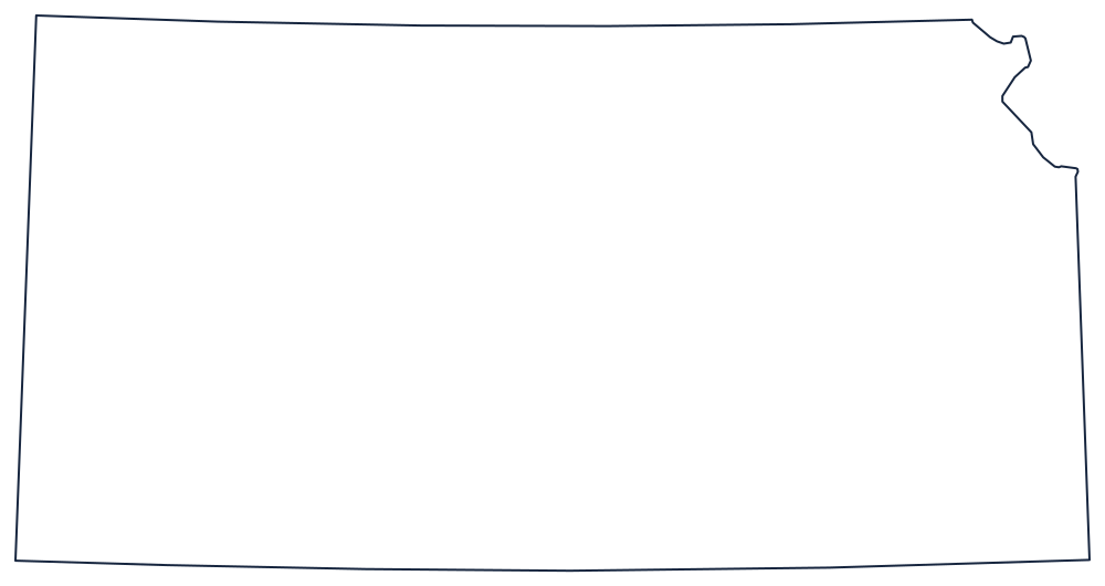
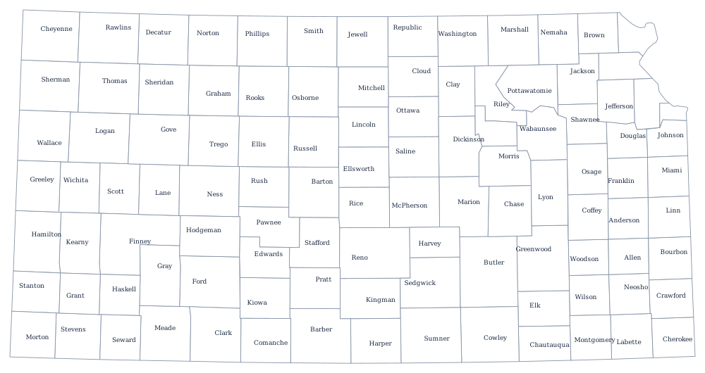
Kansas is the classic survey-drawn state: three ruled sides and one river notch in the northeast where the Missouri interrupts. The blank Kansas map page has a print-sized outline, and the Kansas county map lays out all 105 counties, most of them near-identical rectangles in the west.
Neighboring states
North is Nebraska across a line of latitude, south is Oklahoma across another, west is Colorado, and east is Missouri. Kansas sits in the West North Central division of the Midwest, on the boundary where the Midwest becomes the West. The Mountain time zone page covers the four-county exception in the far west; the US map with states shows the whole grid.