US Map / Time Zones / Hawaii-Aleutian Time
Hawaii–Aleutian Time Zone Map
One zone, two places 2,500 miles apart, and only one of them observes daylight saving time.
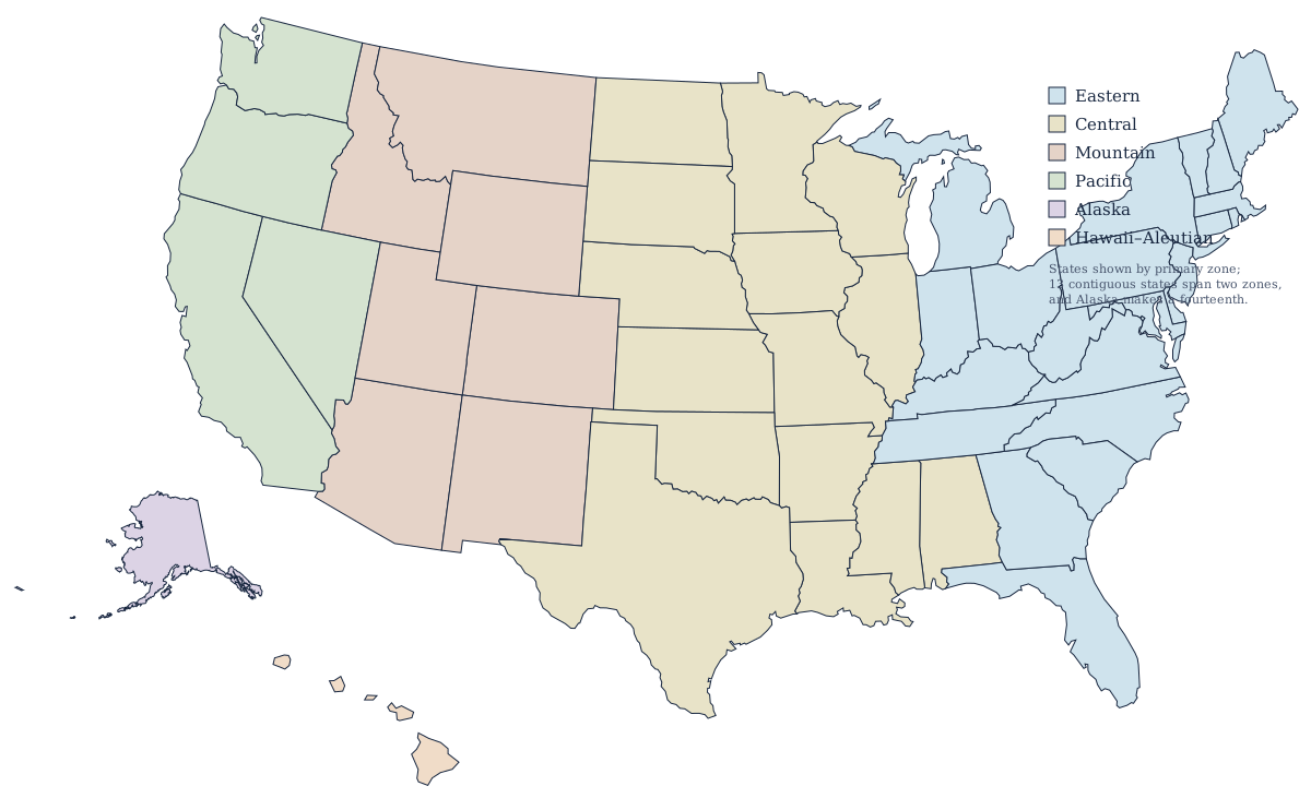
The only US zone that never changes its clocks
Hawaii has not observed daylight saving time since 1967, when it opted out under the Uniform Time Act of 1966. At 21 degrees north the difference between the longest and shortest day of the year is only about two and a half hours, so shifting the clock buys almost nothing. Hawaii therefore sits on Hawaii–Aleutian Standard Time, UTC−10, all year, and its offset from the mainland changes twice a year without Hawaii doing anything at all.
| Standard time (HST) | UTC−10 |
| Daylight time (HDT) | UTC−9, observed only in the Alaskan Aleutians |
| Hawaii and daylight saving | Not observed — no clock change since 1967 |
| States in the zone | Hawaii, plus part of Alaska |
| Alaskan portion | Aleutian Islands west of 169°30′W |
| Gap to Pacific Time | 2 hours in winter, 3 hours in summer |
Why the zone has two names
Because it covers two places 2,500 miles apart. The Aleutian Islands of Alaska west of 169°30′W — Adak, Atka, and the rest of the western chain — share Hawaii's UTC−10 offset in winter. Unlike Hawaii, they do observe daylight saving, moving to Hawaii–Aleutian Daylight Time, UTC−9, from March to November. So for eight months of the year the two halves of a single named zone are an hour apart, and the abbreviation HDT applies to a few hundred residents in the Aleutians and to nobody in Hawaii. Everything in Alaska east of that line uses Alaska Time instead.
What this means for calling the mainland
From November to March, Hawaii is two hours behind Pacific Time, three behind Mountain, four behind Central, and five behind Eastern. From March to November each of those gaps grows by an hour, because the mainland springs forward and Hawaii does not: three hours to Los Angeles and six to New York. Business hours in Honolulu overlap the east coast working day for barely two hours in summer, which is the practical reason so much Hawaii–mainland work is scheduled early in the morning.
Geography of the zone
The Hawaiian Islands run about 1,500 miles northwest from the Big Island, though the eight main islands occupy only the southeastern end of that chain. Honolulu, on Oahu, is the state capital and by far the largest city; Hilo and Kailua-Kona sit on Hawaii Island, where Mauna Loa and Kilauea remain active. The Aleutian half of the zone is a volcanic arc of its own, curving southwest from the Alaska Peninsula toward Kamchatka and crossing the 180th meridian. Hawaii is part of the Pacific division of the West, the only Census division that is not geographically contiguous.
The other five zones
Alaska, Pacific, Mountain, Central, and Eastern make up the rest of the country; all six are compared on the US time zones map.