US Map / Geography / Atlantic Coast
Atlantic Coast Map
The Atlantic seaboard changes character abruptly at Long Island, where the ice sheet stopped.
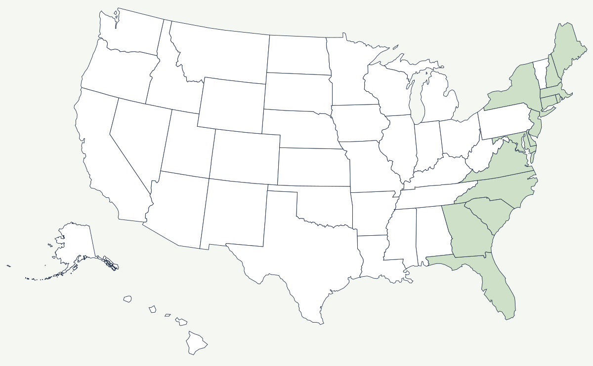
North of New York the coast is drowned rock: fjord-like inlets, granite headlands, thousands of islands, and harbors that are deep because glaciers gouged them. South of New York it is sand: barrier islands, shallow sounds, salt marsh and sediment washed off the Appalachians, with no natural deepwater harbor for hundreds of miles at a stretch. The dividing line is the terminal moraine that runs the length of Long Island and Cape Cod.
Which states are on the Atlantic Coast?
Fourteen. From the Canadian border south: Maine, New Hampshire, Massachusetts, Rhode Island and Connecticut in New England; then New York, New Jersey, Delaware, Maryland and Virginia around the mid-Atlantic bays; then North Carolina, South Carolina, Georgia and Florida down the southern barrier chain. Pennsylvania and the District of Columbia reach tidewater on the Delaware and Potomac but have no ocean shore.
| States with ocean shore | fourteen, from Maine to Florida |
| General coastline | about 2,069 miles |
| Tidal shoreline | about 28,700 miles, counting bays, sounds and river mouths |
| Largest estuary | Chesapeake Bay — the drowned lower valley of the Susquehanna |
| Glacial limit | the terminal moraine forming Long Island and Cape Cod |
| Barrier chain | nearly continuous from New Jersey to Florida |
| Offshore current | the Gulf Stream, which runs closest to shore off Cape Hatteras |
Notable places along the coast
Chesapeake Bay is the largest estuary in the country: the Susquehanna's valley, flooded when sea level rose after the last glaciation, with the Potomac, the James and the Rappahannock flooded alongside it. Its shape gave Maryland and Virginia more shoreline than anywhere else on the seaboard and gave Norfolk and Virginia Beach the deepwater anchorage at Hampton Roads. Further south the Outer Banks stand up to thirty miles offshore, enclosing Pamlico and Albemarle sounds; the shoals off Cape Hatteras, where cold and warm currents meet, have wrecked enough shipping to be called the Graveyard of the Atlantic. New York owes its existence to the one great exception in the middle: a deep, sheltered, ice-free harbor at the mouth of a navigable river that reaches 150 miles inland.
The fall line and the cities strung along it
Inland from the beaches the soft sediments of the Coastal Plain meet the hard crystalline rock of the Piedmont, and every river crossing that contact drops over rapids. That contact is the fall line, and it did two things at once: it stopped boats, and it supplied water power. So the seaboard's second row of cities sits on it, in a nearly straight line from New England to Georgia — Trenton, Philadelphia on the Schuylkill's falls, Baltimore, Washington at the head of Potomac navigation, Richmond at the falls of the James, Raleigh, Columbia, Augusta and Macon. Each began as the point where cargo had to be unloaded, and each grew mills where the river dropped. The pattern is old enough that it shaped where colonial capitals went, and it is still visible in the way Interstate 95 threads from one of those cities to the next.
South of Florida the shore turns into the Gulf Coast, and inland it rises to the Appalachian Mountains and, in the south, the Great Smoky Mountains. The opposite shore of the country is the Pacific Coast. See the physical geography of the United States, or the state pages for Virginia and Massachusetts.