US Map / Geography / Great Smoky Mountains
Great Smoky Mountains Map
The state line between Tennessee and North Carolina runs along the crest of this range for about seventy miles.
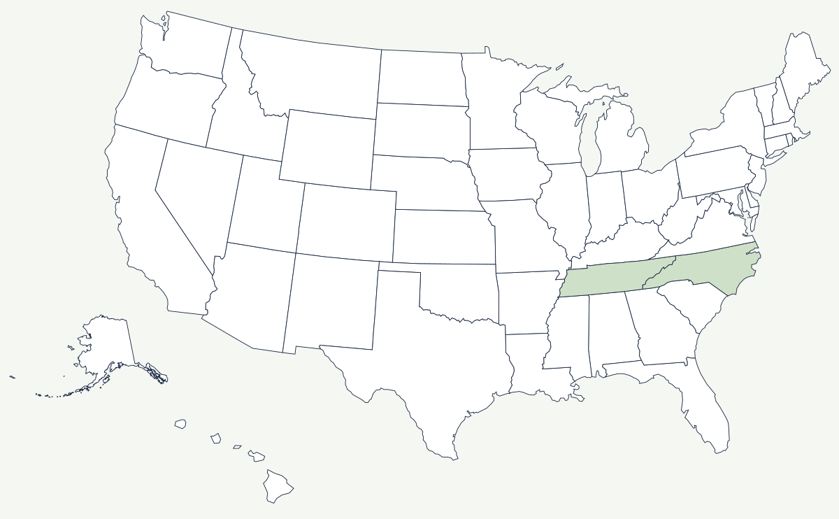
The Smokies are the highest section of the Appalachians and one of the wettest places in the United States outside the Pacific Northwest. Sixteen summits rise above 6,000 feet, the ridges hold spruce-fir forest that belongs three states further north, and the haze the range is named for is a natural product of the vegetation itself.
Which states do the Great Smoky Mountains cross?
Two. The range sits astride the boundary between eastern Tennessee and western North Carolina, and for roughly seventy miles the state line is the crest — one of the few American borders drawn along a watershed divide rather than a survey line or a river. The Tennessee side falls steeply toward Gatlinburg and the Tennessee Valley; the North Carolina side drops toward Cherokee down the Oconaluftee, which reaches the Tennessee by way of the Tuckasegee and the Little Tennessee. Great Smoky Mountains National Park straddles the line, with roughly half its acreage in each state.
| Feature | Elevation or figure |
|---|---|
| Kuwohi (Clingmans Dome) | 6,643 ft — highest point in Tennessee and in the park |
| Mount Guyot | 6,621 ft |
| Mount Le Conte | 6,593 ft |
| Newfound Gap | 5,046 ft — the only paved crossing of the range inside the park |
| Park area | roughly 522,000 acres, split between two states |
| Appalachian Trail | about 71 miles along the crest inside the park |
| Summits above 6,000 ft | sixteen |
Notable places in the range
Kuwohi, long shown on maps as Clingmans Dome and renamed in 2024 at the request of the Eastern Band of Cherokee Indians, is the highest ground on the Appalachian Trail as well as in Tennessee; its summit spruce-fir stand has been badly damaged by an introduced insect. Cades Cove is a flat limestone-floored valley ringed by mountains, farmed until the park bought it out and now kept open as pasture, which is why it holds the park's largest concentration of visible wildlife and its worst traffic. Newfound Gap, where US 441 crosses at 5,046 feet, is where Franklin Roosevelt dedicated the park in 1940, standing with one foot in each state. On the North Carolina side the town of Cherokee sits on the Qualla Boundary, the land held by the descendants of Cherokee people who avoided or returned from removal.
A park bought rather than carved
Western national parks were cut out of land the federal government already owned. The Smokies were not. By the 1920s the range was in the hands of timber companies logging it hard, and creating the park meant buying more than six thousand separate tracts — funded by appropriations from Tennessee and North Carolina, public subscription, and a five-million-dollar gift from the Rockefeller family. Some 1,200 families were bought out or removed, and the log buildings kept standing at Cades Cove and Cataloochee are what remains of their communities. The park has charged no entrance fee since it opened, because Tennessee transferred the Newfound Gap road on the condition that no toll ever be collected on it, and that is a large part of why it records more visits than any other national park in the country — more than the Grand Canyon and Yosemite combined in a typical year.
The Smokies are the high point of the Appalachian Mountains, and their streams feed the Tennessee River by way of the French Broad and the Little Tennessee. Further west lie the Ozarks. See the physical geography of the United States, or the state pages for Tennessee and North Carolina.