Maryland Map
The Chesapeake Bay splits Maryland nearly in two, and near Hancock the state narrows to under two miles wide. Capital: Annapolis. Largest city: Baltimore.
Maryland at a glance
| Capital | Annapolis |
| Largest city | Baltimore |
| Abbreviation | MD |
| Population | 6,263,220 (2024 Census estimate) |
| Land area | 9,707 sq mi |
| Region | South (South Atlantic division) |
| Time zone | Eastern Time, statewide |
| Counties | 23 counties plus Baltimore city, which has been independent of any county since 1851 |
| Statehood | 1788 (7th state) |
| Borders | Delaware, Pennsylvania, Virginia, West Virginia, the District of Columbia, and the Atlantic |
Major cities
Baltimore is the largest city at 568,271 in 2024 and the only one in the state that belongs to no county — it was separated from Baltimore County in 1851 and the two have been counted apart ever since. The real weight of population, though, is in the Washington suburbs: Montgomery County reached 1,082,273 and Prince George’s County 966,629, so between them they outnumber the city three to one.
Much of suburban Maryland is unincorporated, which is why places as large as Columbia and Silver Spring never appear on city rankings. Annapolis, the capital on the Severn River and home of the Naval Academy, has fewer than 45,000 residents. Anne Arundel County (602,350) and Howard County (339,668) fill in the corridor between the two metros; the full list is on the Maryland county map.
Geography
Maryland's outline is the product of three arguments. The Mason–Dixon Line along the north was surveyed between 1763 and 1767 to end the Calvert–Penn boundary dispute, and later became the shorthand for the divide between free and slave states. The Potomac River in the south belongs to Maryland in its entirety, right up to the Virginia shore, under a colonial charter still being argued in the Supreme Court as recently as 2003. Where those two lines converge near Hancock, the state is about 1.8 miles wide.
The Chesapeake Bay, the largest estuary in the United States at roughly 200 miles long, runs down the middle and separates the Eastern Shore from the rest. Only one road crossing links the two halves in Maryland: the twin spans of the Bay Bridge. West of Baltimore the Piedmont rises to the Blue Ridge and then to the Allegheny Plateau, where Backbone Mountain in Garrett County is the high point at 3,360 ft — the Appalachians at their narrowest squeeze between Pennsylvania and West Virginia. Maryland’s open Atlantic coast is only about 31 miles long, behind Ocean City and Assateague Island. The state also ceded the land that became the District of Columbia in 1790.
Printable Maryland maps
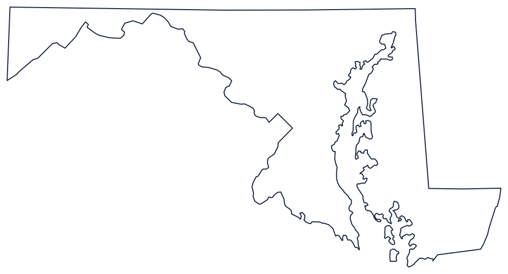
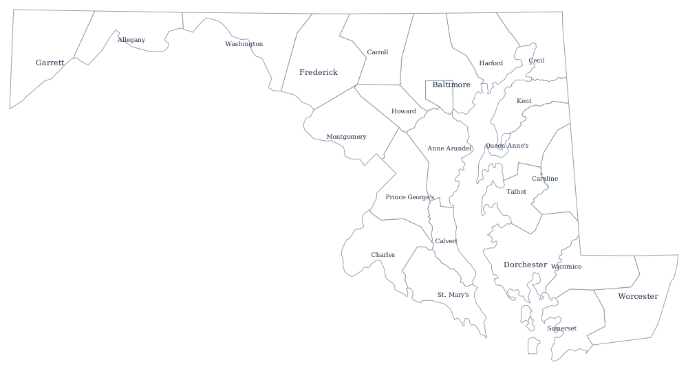
No state outline rewards a large print more than Maryland's, with the bay, the Eastern Shore and the panhandle all in one shape. Download the SVG above or use the blank Maryland map; the county sheet shows all 24 divisions including Baltimore city.
Neighboring states
Maryland wraps around Delaware on the Delmarva Peninsula, meets Pennsylvania along the Mason–Dixon Line, and faces Virginia and West Virginia across the Potomac. Its two Eastern Shore counties also touch Virginia’s. Compare the whole seaboard on the US map with states.