US Map / Geography / Mojave Desert
Mojave Desert Map
The lowest point in North America and an 11,000-foot peak stand fifteen miles apart inside the same national park.
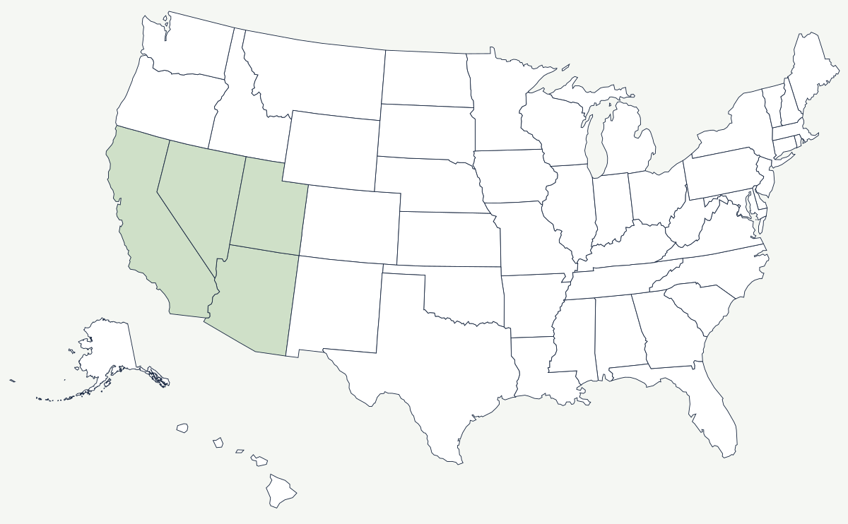
The Mojave is the smallest of the North American deserts and the one squeezed between the other two: colder and higher than the Sonoran to the south, warmer and lower than the Great Basin to the north. Botanists draw its outline by following the Joshua tree, which grows here and essentially nowhere else, so the desert's boundary is defined by a plant rather than by a line of latitude or a mountain front.
Which states does the Mojave Desert cover?
Four. The bulk of it is in southeastern California, from the Tehachapi and San Gabriel mountains east across the Antelope Valley, Death Valley and the Mojave National Preserve. Nevada holds the northeastern portion, including the valley that Las Vegas, Henderson and North Las Vegas occupy. A corner reaches into northwestern Arizona around Lake Mead and the lower Colorado, and the desert's northeastern tip crosses into the southwestern corner of Utah near St. George. The Colorado River is its eastern boundary for much of that distance.
| States | California, Nevada, Arizona, Utah |
| Area | roughly 47,000 square miles, depending on where the boundary with the Sonoran and Great Basin deserts is drawn |
| Indicator species | the Joshua tree, whose range is used to map the desert's edges |
| Lowest point | Badwater Basin, Death Valley — 282 feet below sea level, the lowest land in North America |
| Highest point nearby | Telescope Peak, 11,043 ft, about fifteen miles from Badwater and inside the same national park |
| Rainfall | under six inches a year across most of it; Death Valley averages under two |
| Temperature record | the 134°F reading at Furnace Creek in July 1913 is still the official world record, though many climatologists dispute it; the 130°F readings of 2020 and 2021 are less contested |
Notable places in the desert
Death Valley is a fault-bounded trough where the floor has dropped while the ranges on either side rose, which is how a salt pan below sea level ends up in the shadow of an 11,000-foot ridge carrying bristlecone pines. Joshua Tree National Park sits at the desert's southern boundary, straddling the transition to the Sonoran, and the change in vegetation across a few miles of road is the clearest place to see where one desert ends. The Mojave River runs north out of the San Bernardino Mountains and disappears — most of its course is underground, and it ends in a dry sink rather than reaching any sea. The dry lakebeds are flat and hard enough to land on: Rogers Dry Lake at Edwards Air Force Base served as the runway for most of the X-plane program and for many Space Shuttle landings.
Water, and how it placed the cities
Every settlement here started at a spring. Las Vegas began as artesian meadows on the Old Spanish Trail — the name means the meadows — and was chosen as a Mormon mission site in 1855 for that reason, then as a railroad division point in 1905. The springs stopped flowing decades ago; the valley now runs almost entirely on Nevada's share of the Colorado River, drawn from Lake Mead behind Hoover Dam, and Nevada's allocation under the 1922 compact is the smallest of the seven basin states. Southern California's route through the desert follows the same logic: the Los Angeles Aqueduct crosses it from the Owens Valley, the Colorado River Aqueduct crosses it from the east, and Interstate 15 runs between the two cities along a corridor first established by wagon road and then by rail. The open space and reliable clear weather have drawn the uses that need both — military ranges, flight test centers and, more recently, some of the largest solar installations in the country.
The desert's eastern boundary is the Colorado River, its western wall is the southern end of the Sierra Nevada, and to the north the closed basins run on toward the Great Salt Lake. Beyond the coastal ranges lies the Pacific Coast. See the physical geography of the United States, or the state pages for California and Nevada.