US Map / County Maps / Texas
Texas County Map
Texas has 254 counties, more than any other state, and the least populous of them has 48 people.
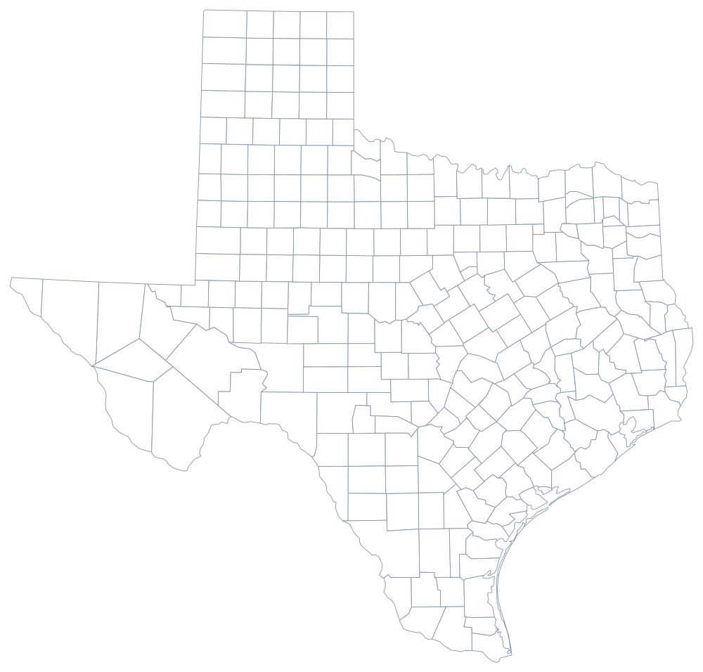
The Republic of Texas inherited the municipalities of Mexican Coahuila y Tejas and turned twenty-three of them into counties in 1836. The state then kept creating more for a century. In 1876 a new constitution required counties to be at least 900 square miles and a county seat to be near the center, and the legislature obliged by ruling the entire panhandle into a grid of thirty-mile squares in 1876 — fifty-four counties in a single act, most of them empty. The last of them, Kenedy County, was organized in 1921.
The 254 counties of Texas
The ten below hold 59% of Texans, and the top four are Houston, Dallas, Fort Worth, and San Antonio. Harris County alone has more residents than 25 states.
| County | County seat | Population (2024 estimate) |
|---|---|---|
| Harris County | Houston | 5,009,302 |
| Dallas County | Dallas | 2,656,028 |
| Tarrant County | Fort Worth | 2,230,708 |
| Bexar County | San Antonio | 2,127,737 |
| Travis County | Austin | 1,363,767 |
| Collin County | McKinney | 1,254,658 |
| Denton County | Denton | 1,045,120 |
| Fort Bend County | Richmond | 958,434 |
| Hidalgo County | Edinburg | 914,820 |
| El Paso County | El Paso | 875,784 |
Commissioners courts, and counties that cannot pass ordinances
Every Texas county, from Harris with five million people to Loving with 48, is governed the same way: a commissioners court made up of a county judge elected county-wide and four commissioners elected from precincts. The county judge is an executive who in smaller counties also hears probate and misdemeanour cases; the four commissioners have historically each run the roads in their own precinct, which is why a county road can change quality at a precinct line.
What Texas counties cannot do is legislate. A county has only the powers the legislature grants it, and general ordinance-making authority is not among them: outside city limits a Texas county generally cannot zone, cannot adopt a building code for houses, and cannot ban much of anything. That is the single most consequential fact about local government in Texas, and it is why unincorporated subdivisions sprawl at the edges of every metropolitan area, why colonias grew along the Rio Grande without water or sewer service, and why cities were given extraterritorial jurisdiction over land beyond their limits as a partial substitute.
Largest and smallest counties
Harris County is the third most populous county in the United States, 5,009,302 in the 2024 estimates, and contains Houston. Dallas County follows at 2,656,028 with Dallas, Tarrant County at 2,230,708 with Fort Worth and Arlington, and Bexar County holds San Antonio. The smallest is Loving County in the Permian Basin, 48 residents — the least populous county in the United States, with its courthouse at Mentone, which has no school, no church, and no cemetery. Brewster County in the Big Bend is the largest by land area at about 6,180 square miles, larger than Connecticut and Rhode Island combined.
The Texas state page has the cities and the geography, and the county map index has the other 49 states. Bordering county maps: Louisiana, Arkansas, Oklahoma, and New Mexico. The Rio Grande page follows the river that forms the entire southern county line.