US Map / Printable US Maps / Letter & A4 Size
Printable US Map for Letter and A4 Paper
Three files, one print dialog, and about six settings that decide whether the map fills the sheet or lands in the middle of it at half size.
Which of the three files to print
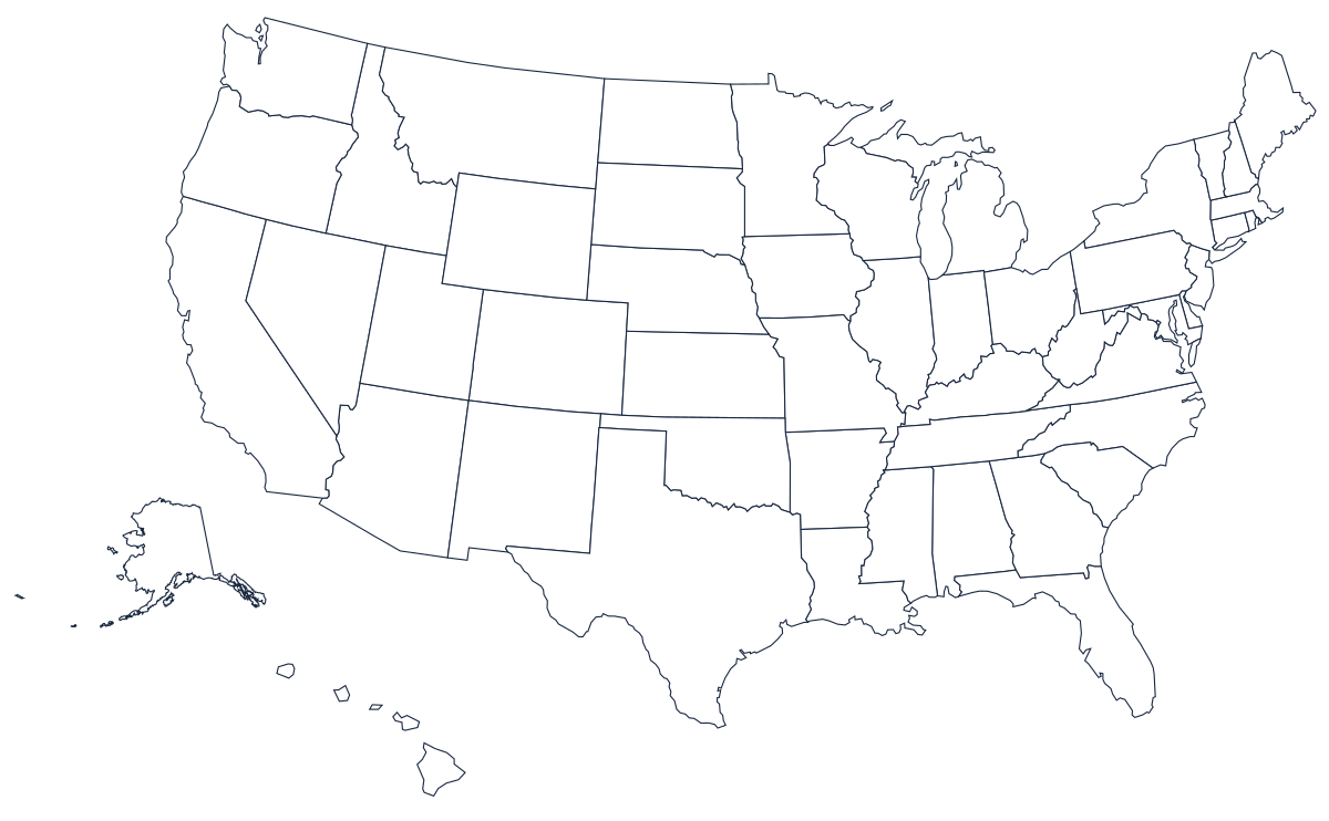
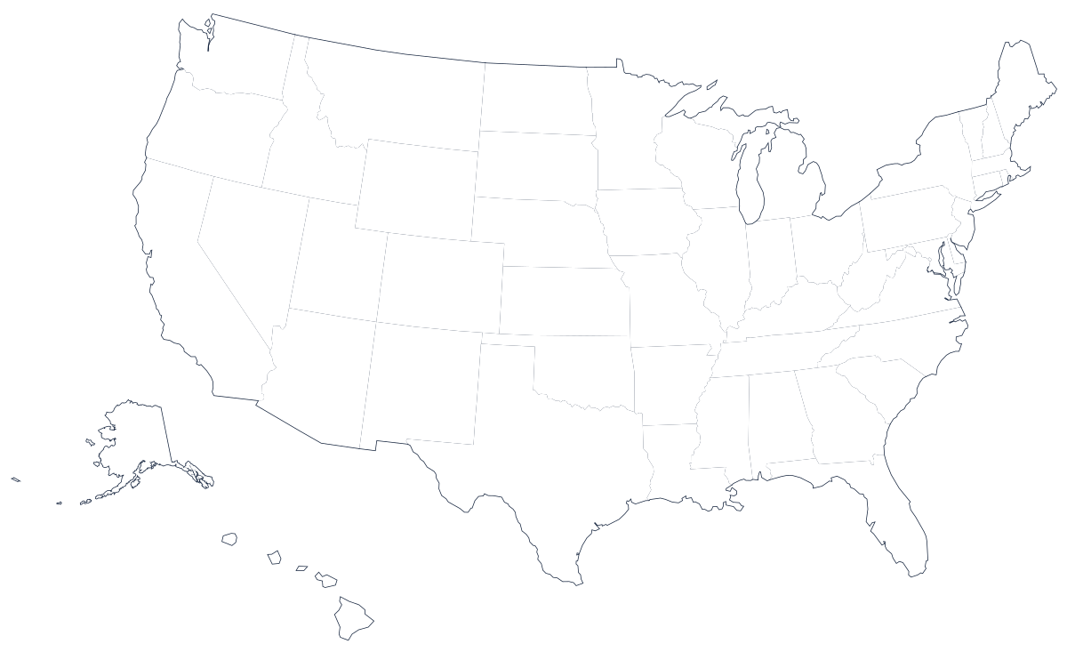
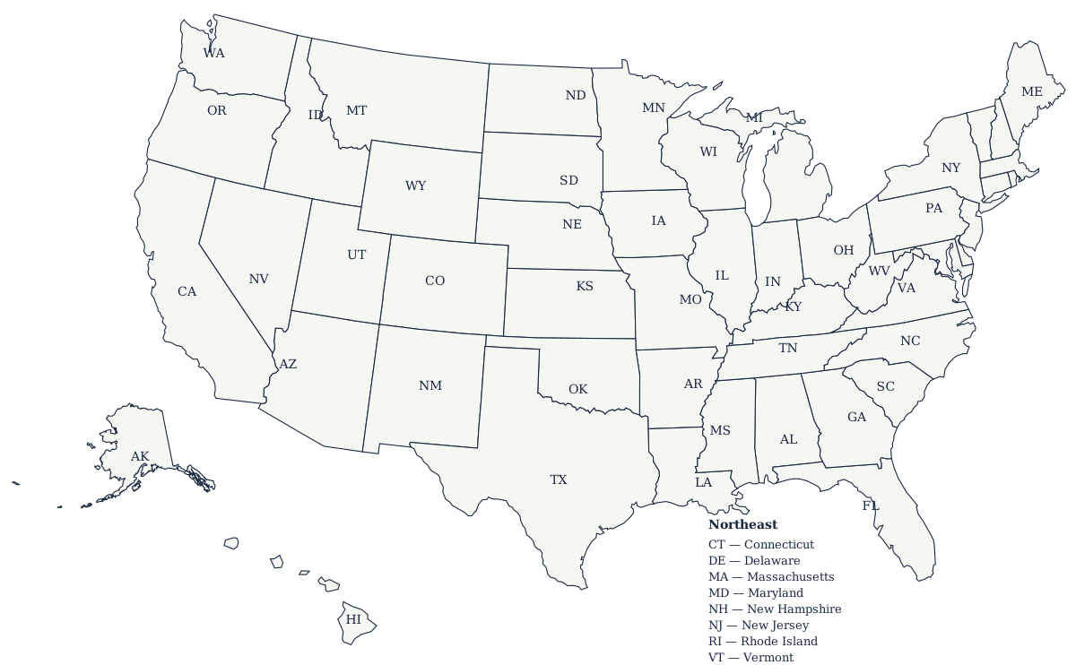
There are three country maps here and they are not interchangeable. The blank map with state borders has every internal line drawn and no names at all — that is the one for labeling tests, for coloring exercises and for anything where the student needs the borders given to them. The outline map has the national coastline and land border only, with nothing inside it; use it when the task is to draw the state lines, to shade regions that cross state boundaries, or to plot routes and rivers without the clutter. The labeled map has every state named and is the answer key.
Each of the three comes as an SVG and a PDF. Print the PDF: it carries the page setup with it and every reader on every operating system will place it the same way. Use the SVG when you want to open the file in a drawing program, recolour it, or drop it into a worksheet you are building yourself.
Landscape, and 100% versus fit to page
All three maps are much wider than they are tall — the artwork is about 1200 by 742 units, a ratio of roughly 1.6 to 1 — so set the orientation to landscape before anything else. In portrait the map lands in the middle of the sheet at about half the usable height and the state shapes become too small to label by hand.
Then choose the scale. Fit to page (sometimes "shrink oversized pages" or "scale to fit") is what you want almost every time: the map grows or shrinks until it touches the printable area, which is exactly the behaviour a classroom set needs. Use 100% or "actual size" only when you are printing something that has to match a fixed measurement — a map that must line up with an overlay, or a set of sheets that will be taped together. At 100% the PDF may be larger than the sheet and the edges will be cut off without warning.
Letter and A4 are not the same shape
US Letter is 8.5 by 11 inches; A4 is 210 by 297 millimetres, which is narrower and taller. In landscape that gives Letter a printable field of roughly 10 by 7.5 inches and A4 roughly 11 by 7.7 inches once standard margins are taken off. Because the map is wider in proportion than either sheet, it is the width that limits the print in both cases: the map fills the paper left to right and leaves white space at the top and bottom. That white band is useful — it is where a title, a name and a date go — so resist the urge to eliminate it by cropping.
Set margins to the printer's minimum rather than to zero. Almost no consumer printer is truly borderless, and asking for a zero margin usually makes the driver silently scale the page down instead. If your printer clips the left or right edge of the coastline, drop the scale to 95% and reprint; the loss in size is invisible and the whole map lands on the sheet.
Why these files stay sharp at any size
Both the SVG and the PDF are vector files. They store the coastline as a list of curves and line segments rather than as a grid of pixels, so the printer redraws them at whatever resolution it is capable of. There is no such thing as a "300 dpi version" of these maps — a 4-inch print and a 4-foot print come out of the same file, and both are as crisp as the device can make them. That is the whole reason the site does not offer PNG or JPG downloads.
Toner, color and reuse
Print in greyscale or black and white. The blank maps are line art on white with no fills, so a color cartridge contributes nothing and costs a great deal over a class set; choosing greyscale in the print dialog is usually a 60–80% saving on a 30-sheet run. The labeled map is worth one color copy for the wall and greyscale for everything else.
If a class will fill the same map in repeatedly, print one copy on the heaviest paper your printer takes and laminate it, or slide it into a clear document pocket. Dry-erase markers wipe cleanly off both, and a single laminated blank map survives a term of labeling practice where a paper one lasts an afternoon.
Where to go next
For a map bigger than a single sheet — a wall map, a classroom display, a poster — see printing a US map as a poster, which covers tiling across sheets and taking the file to a print shop. For a full lesson built around these files, with an answer key and single-state assignments, see the US map worksheet page. Every download on the site is indexed on the printable US maps hub.
Individual states print the same way and at the same settings: pick one from the printable blank map page — Texas and California are the usual first requests. The state outlines are SVG only; there are no per-state PDFs, so print those from the browser or place the SVG in a document first. When the sheets are filled in, the US map quiz checks the same fifty shapes on screen.