US Map / Geography / Lake Superior
Lake Superior Map
Lake Superior holds more water than the other four Great Lakes put together.
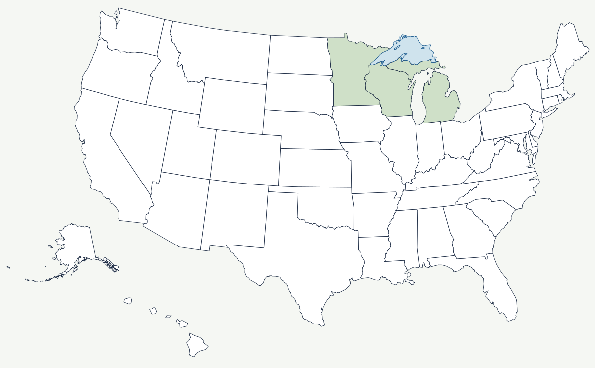
Superior covers about 31,700 square miles, reaches 1,332 feet deep, and sits at roughly 600 feet above sea level — higher, colder and emptier than the rest of the chain. It is the largest freshwater lake in the world by surface area, and because it is deep as well as broad it holds around a tenth of the planet's surface fresh water in one basin.
Which states border Lake Superior?
Three, plus one Canadian province. Minnesota has the northwestern shore, the Arrowhead country from Duluth up to the Pigeon River. Wisconsin holds the southwestern corner, including the Apostle Islands and the Bayfield peninsula. Michigan takes the whole southern and eastern shore along the Upper Peninsula, from the Porcupine Mountains to Whitefish Point and the outlet at Sault Ste. Marie. The northern shore is Ontario, and the international boundary runs down the middle of the lake — placing Isle Royale, which is far closer to Ontario and Minnesota than to the rest of Michigan, inside the state of Michigan.
| Surface area | about 31,700 square miles — the largest freshwater lake on Earth by area |
| Maximum depth | 1,332 ft |
| Surface elevation | about 600 ft above sea level |
| Volume | more than the other four Great Lakes combined |
| US states on its shore | Minnesota, Wisconsin, Michigan |
| Outlet | the St. Marys River to Lake Huron, dropping 21 feet at the Soo Locks |
| Water temperature | cold year round; the lake seldom freezes over completely |
Notable places on the lake
Duluth, Minnesota, and Superior, Wisconsin, share a harbor behind a sand spit at the lake's western tip. It is the farthest-inland point an ocean-going ship can reach in North America — about 2,300 miles from the Atlantic by way of the Seaway — and for a century it has shipped iron ore and grain out and coal and cement in. The nearest large city is Minneapolis–St. Paul, about 150 miles inland, connected by the rail lines that carried the ore. On the Michigan shore, Pictured Rocks is a fifteen-mile wall of stained sandstone cliffs, and Whitefish Point marks the approach to the locks where the ore carrier Edmund Fitzgerald went down in a November gale in 1975. Isle Royale, a roadless island national park, has hosted the longest continuous study of a predator and prey population anywhere — wolves and moose, watched since 1958.
How the lake and its ore built the border country
The boundary west of Superior was left vague by the 1783 treaty, which described a route through waterways nobody had surveyed properly. The Webster-Ashburton Treaty of 1842 finally fixed it along the Pigeon River line, and the United States kept the Arrowhead — the corner of Minnesota that turned out to contain the Vermilion and Mesabi iron ranges. The Mesabi, opened in the 1890s, was shallow enough to strip-mine and rich enough to supply most of the country's iron for two world wars, and every ton of it left by boat from Duluth or Two Harbors, down the lake and through the Soo Locks to the mills at Cleveland, Detroit and Gary. The lake's weather is the other permanent fact of life here: cold water beside cold land produces lake-effect snow measured in hundreds of inches on the Keweenaw Peninsula.
Superior is the head of the chain described on the Great Lakes page; it drains through the St. Marys River into Lake Huron, which sits at the same level as Lake Michigan, and on to the Atlantic. Its watershed sits just north of the headwaters of the Mississippi River. See the physical geography of the United States, or the state pages for Minnesota and Michigan.