US Map / Geography / Lake Michigan
Lake Michigan Map
Two states had their northern borders redrawn so that they would touch this lake.
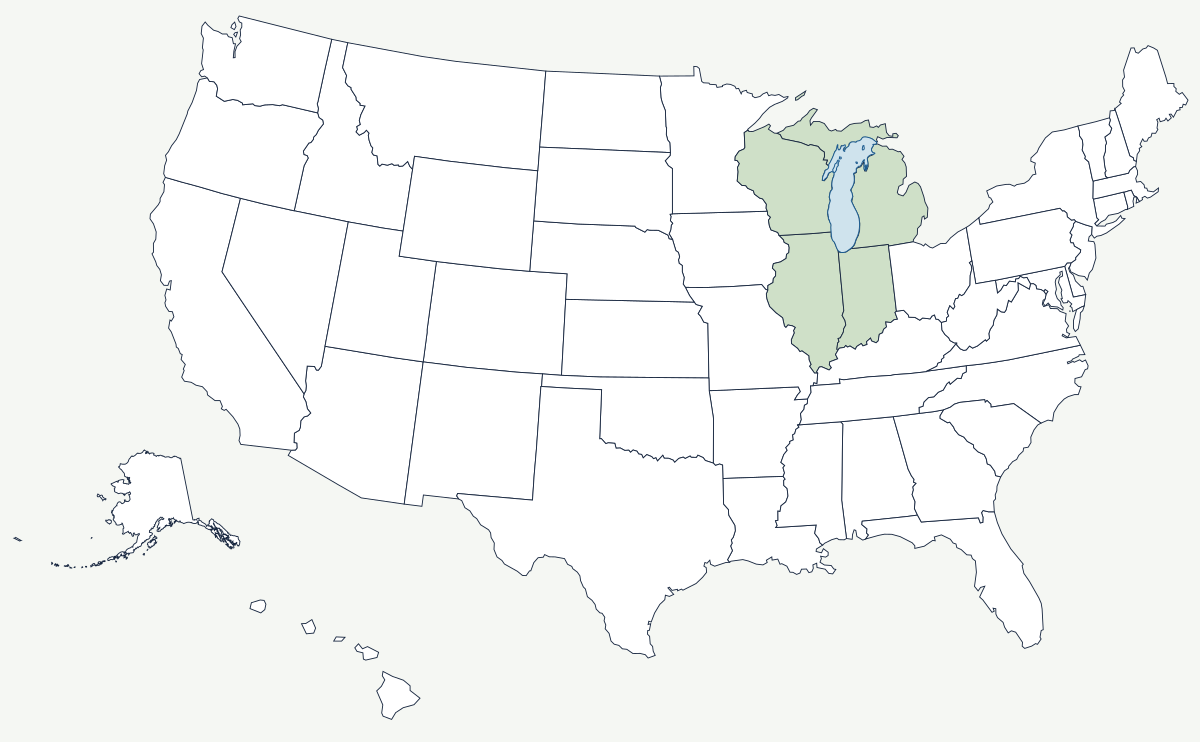
Lake Michigan is about 307 miles long, 118 miles across at its widest, and 925 feet deep at its deepest point. It is the only one of the five Great Lakes that lies wholly inside the United States, and it is joined to Lake Huron at the Straits of Mackinac — the two sit at exactly the same level and exchange water freely, so hydrologically they are one lake with two names.
Which states border Lake Michigan?
Four. Michigan holds both the eastern shore of the Lower Peninsula and the northern shore along the Upper Peninsula. Wisconsin has the western shore from the Door Peninsula down past Milwaukee to the Illinois line. Illinois has a short but decisive stretch at the southwestern corner, and Indiana an even shorter one at the southern tip, where the dunes and the steel mills are. The Mackinac Bridge, opened in 1957 and about five miles long, ties Michigan's two peninsulas together across the straits.
| Surface area | about 22,300 square miles — third largest of the five lakes by area, second by volume |
| Maximum depth | 925 ft |
| Surface elevation | about 577 ft, the same as Lake Huron |
| Length and width | roughly 307 miles by 118 miles |
| States on its shore | Michigan, Wisconsin, Illinois, Indiana |
| Connection | the Straits of Mackinac, to Lake Huron |
| Distinction | the only Great Lake entirely within the United States |
Notable places on the lake
Chicago sits at the southwestern corner, on the low portage that separates the Great Lakes basin from the Mississippi basin by only a few miles of wet prairie. The city cut that divide open — first with the Illinois and Michigan Canal in 1848, then in 1900 by reversing the Chicago River so its sewage flowed toward the Mississippi instead of the water supply — and the resulting canal is still the only artificial link between the two great watersheds, which is why it is now fitted with electric barriers to stop invasive carp. Milwaukee grew on the western shore as a brewing, milling and machine-tool port. On the Michigan side, Sleeping Bear Dunes rises 450 feet straight off the water, and the belt of orchards behind it exists because the lake keeps spring frosts late and autumn frosts early. Indiana Dunes, wedged between steel mills, became a national park in 2019.
The lake that moved two state lines
Congress understood that a Great Lakes port was worth more than farmland. When Indiana was admitted in 1816 its northern boundary was pushed ten miles north of the Northwest Ordinance line so the new state would reach the lake at all — which is why Indiana has a shoreline and Michigan City exists. Two years later Illinois made the same argument at larger scale: its northern line was moved about fifty miles north, to 42°30′, on the reasoning that the state needed a lake harbor to bind it to the north rather than only to the Mississippi and the South. That single adjustment put Chicago, and the fourteen northern counties around it, in Illinois instead of Wisconsin. Michigan lost the other end of the argument: the Toledo War of 1835–36 cost it the strip of land at the mouth of the Maumee and won it the Upper Peninsula in exchange, a swap that looked like a poor deal until the copper and iron were found.
The lake is one of the five described on the Great Lakes page; its northern neighbor is Lake Superior. The canal at Chicago links it to the Mississippi River system, and the prairie west of it runs out into the Great Plains. See the physical geography of the United States, or the state pages for Michigan and Illinois.