US Map / County Maps / Nebraska
Nebraska County Map
Three Nebraska counties hold more than half the state; some of the others have fewer than 500 people.
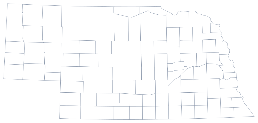
Nebraska was organized from the east. The first counties were strung along the Missouri River in 1854 and 1855, and settlement followed the Platte valley and the railroads westward for the next fifty years. The Sandhills — 20,000 square miles of grass-stabilised dunes in the north-center — defeated the homesteaders, so the counties there were drawn large and stayed empty. The last county organized was Arthur, in 1913, in the middle of that country.
The 93 counties of Nebraska
Douglas, Lancaster, and Sarpy — Omaha, Lincoln, and the suburbs between them — hold 57% of the state's people between them. The ten below reach 71%, leaving the other 83 counties to divide the rest.
| County | County seat | Population (2024 estimate) |
|---|---|---|
| Douglas County | Omaha | 601,158 |
| Lancaster County | Lincoln | 332,857 |
| Sarpy County | Papillion | 204,828 |
| Hall County | Grand Island | 62,869 |
| Buffalo County | Kearney | 51,156 |
| Dodge County | Fremont | 37,884 |
| Scotts Bluff County | Gering | 35,734 |
| Madison County | Madison | 35,579 |
| Platte County | Columbus | 35,499 |
| Lincoln County | North Platte | 33,319 |
Commissioners, supervisors, and counties too small to staff
Nebraska counties come in two forms. Most are commissioner counties with three members elected from districts; about two dozen, mostly in the east, are supervisor counties with seven members and an underlying layer of civil townships that maintain rural roads. Every county, in either form, is required to elect a clerk, treasurer, sheriff, attorney, assessor, surveyor and register of deeds, and the smallest ones cannot fill the list. State law now allows counties under 7,000 residents to combine offices — clerk with register of deeds, treasurer with clerk of the district court — and most of the western counties have done it.
Nebraska has never merged two counties, but it has come close to needing to. Arthur, Blaine, Loup, McPherson, Grant, and Thomas counties each have fewer than a thousand residents; several have no incorporated town but the county seat, and Arthur County's courthouse, built in 1914, is among the smallest in the country. What keeps them going is cattle: the Sandhills counties have very few people and a great deal of taxable rangeland.
Largest and smallest counties
Douglas County, which is Omaha, is the most populous at 601,158 in 2024 — 30% of Nebraska — and Lancaster County, which is Lincoln and the state capital, is second at 332,857. The smallest is McPherson County in the Sandhills, 376 people, among the least populous counties in the country. Cherry County, north of the Sandhills' center, is the largest by land area at roughly 5,960 square miles — larger than Connecticut and Rhode Island together, with about 5,500 residents.
Continue to the Nebraska state page or the county map index. Around the edges: Iowa, Missouri, Kansas, Colorado, and South Dakota. The Great Plains page explains the rainfall gradient that decided which of these counties filled up.