US Map / County Maps / California
California County Map
One California county has more residents than 40 of the 50 states; another has fewer than 1,200 people and not a single incorporated city.
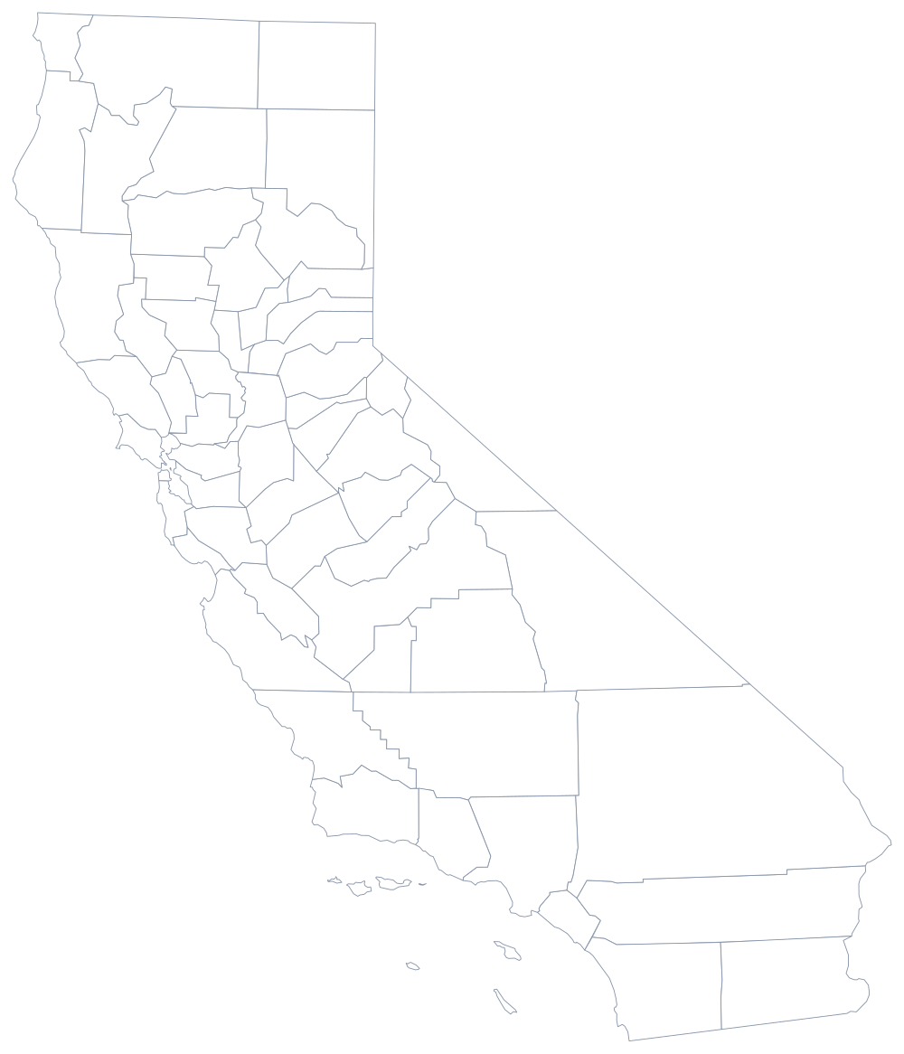
Twenty-seven counties were created at statehood in 1850, before most of the state had been surveyed, and the rest were split off over the next fifty-seven years. The last was Imperial County in 1907; the boundaries have not changed since, which means California's county map is a fossil of nineteenth-century mining, ranching, and Gold Rush county-seat fights rather than a description of where people live now.
The 58 counties of California
These ten counties hold 72% of all Californians. Six of them are in the southern coastal basin or the Bay Area; only Fresno and Sacramento sit inland in the Central Valley.
| County | County seat | Population (2024 estimate) |
|---|---|---|
| Los Angeles County | Los Angeles | 9,757,179 |
| San Diego County | San Diego | 3,298,799 |
| Orange County | Santa Ana | 3,170,435 |
| Riverside County | Riverside | 2,529,933 |
| San Bernardino County | San Bernardino | 2,214,281 |
| Santa Clara County | San Jose | 1,926,325 |
| Alameda County | Oakland | 1,649,060 |
| Sacramento County | Sacramento | 1,611,231 |
| Contra Costa County | Martinez | 1,172,607 |
| Fresno County | Fresno | 1,024,125 |
Charter counties, general-law counties, and one city-county
California counties come in two legal flavours. Forty-four are general-law counties, organized exactly as the state code prescribes, with a five-member board of supervisors and a fixed set of elected officers. Fourteen — Los Angeles, San Diego, Alameda, Fresno and others — are charter counties that have written their own governing documents and can structure their offices as they like. Every county, either way, has just five supervisors, so a Los Angeles County supervisor represents close to two million people, more than a member of Congress.
San Francisco is the single consolidated city and county: its board of supervisors is also the city council and its mayor is also the county executive. Counties matter more in California than in most states because they deliver welfare, public health, jails, and elections on the state's behalf, and because well over a third of Californians live in unincorporated territory where the county is the only local government there is.
Largest and smallest counties
Los Angeles County is the most populous county in the United States, 9,757,179 people in the 2024 estimates — more than 40 of the 50 states — and it alone contains Los Angeles and Long Beach. San Diego County follows at 3,298,799. At the other end, Alpine County in the high Sierra has 1,099 residents, no incorporated city, and no traffic light. San Bernardino County is the largest by land area — about 20,100 square miles, larger than nine states.
Continue to the California state page, or to the county maps of Oregon, Nevada, and Arizona. The county map index covers all 50 states, and the Sierra Nevada page explains the mountain wall that keeps Alpine and Mono counties empty.