US Map / County Maps / Florida
Florida County Map
Florida began with two counties in 1821 and finished with 67 — the last one created in 1925, at the peak of the land boom.
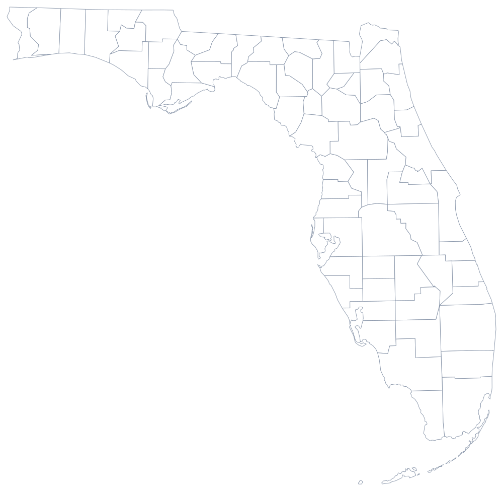
When the United States took Florida from Spain in 1821, Andrew Jackson split it into two counties along the Suwannee River: Escambia to the west, St. Johns to the east. Everything since has been subdivision. The panhandle filled first, so its counties are the small ones; the peninsula was cut up in bursts, most violently during the Florida land boom of the 1920s, when a legislature under pressure from developers created thirteen new counties in five years.
The 67 counties of Florida
These ten counties hold 60% of all Floridians. Three of them — Miami-Dade, Broward, and Palm Beach — are stacked along ninety miles of the south-east coast and together account for more than a quarter of the state.
| County | County seat | Population (2024 estimate) |
|---|---|---|
| Miami-Dade County | Miami | 2,838,461 |
| Broward County | Fort Lauderdale | 2,037,472 |
| Palm Beach County | West Palm Beach | 1,582,055 |
| Hillsborough County | Tampa | 1,581,426 |
| Orange County | Orlando | 1,533,646 |
| Duval County | Jacksonville | 1,055,159 |
| Pinellas County | Clearwater | 965,870 |
| Lee County | Fort Myers | 860,959 |
| Polk County | Bartow | 852,878 |
| Pasco County | Dade City | 659,114 |
Charter counties, consolidated Jacksonville, and the 1925 cut-off
Florida stopped making counties in 1925, when Gilchrist was split from Alachua. Twenty of the 67 are charter counties that have adopted their own constitutions and can pass ordinances that override city rules in some fields; the rest operate under the general state code with a five-member commission, a sheriff, a clerk of court, a property appraiser, a tax collector, and a supervisor of elections all elected separately. That row of independently elected constitutional officers is written into the state constitution, so a Florida county commission controls far less of its own administration than a county board in most states.
Duval County is the exception that swallowed its cities: in 1968 Jacksonville consolidated with the county, producing a single government and, for a while, the largest city by area in the contiguous United States. Miami-Dade went the other way, keeping dozens of municipalities under a strong metropolitan county — the two-tier model it adopted in 1957 and the reason the county, not the city of Miami, runs the transit system, the airport, and the water.
Largest and smallest counties
Miami-Dade County is the most populous at 2,838,461 in the 2024 estimates, containing Miami and Hialeah. Broward County follows at 2,037,472. The smallest is Liberty County, 7,955 people in the Apalachicola River swamps of the panhandle, which has one incorporated town — Bristol, its seat — and whose land is mostly Apalachicola National Forest and commercial pine. Collier and Palm Beach are the largest by land area, each close to 2,000 square miles, most of it Everglades and Big Cypress.
Carry on to the Florida state page or the county map index. Florida touches only two states, and both county maps are here: Georgia and Alabama. The Gulf Coast page follows the shoreline that gives the panhandle counties their southern edge.