US Map / County Maps / Connecticut
Connecticut County and Planning Region Map
Connecticut abolished county government in 1960, and in 2022 the Census Bureau stopped counting Connecticut counties altogether.
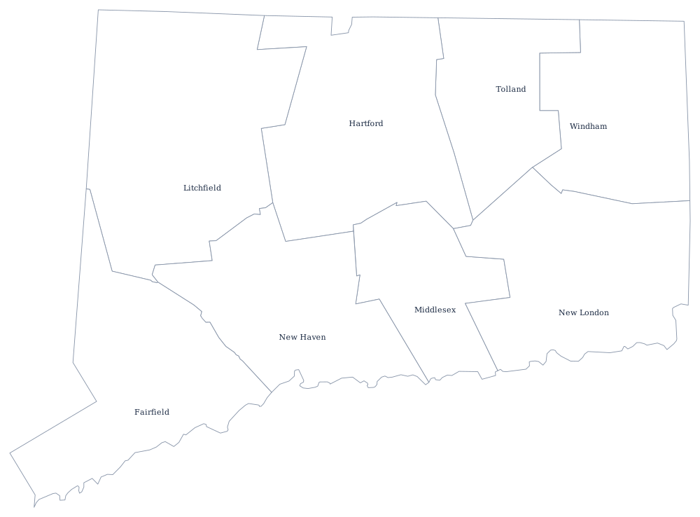
Connecticut is the clearest case in the country of counties that exist on paper and nowhere else. The eight counties were laid out between 1666 and 1785 and functioned for nearly three centuries; the General Assembly then dissolved every county government effective 1 October 1960, transferring the jails to the state and everything else to the 169 towns. Nothing replaced them at the county level. A Connecticut address still names a county, and the courts still use county-based judicial districts, but no one is elected to run one.
The nine planning regions of Connecticut
There is no county seat column here, because there are no county governments to sit anywhere. The units below are the nine councils of governments the Census Bureau adopted as Connecticut's county equivalents in 2022; the Capitol Planning Region is built around Hartford, and the South Central region around New Haven.
| Planning region | Population (2024 estimate) |
|---|---|
| Capitol Planning Region | 991,508 |
| Western Connecticut Planning Region | 637,013 |
| South Central Connecticut Planning Region | 576,718 |
| Naugatuck Valley Planning Region | 462,220 |
| Greater Bridgeport Planning Region | 335,666 |
| Southeastern Connecticut Planning Region | 282,602 |
| Lower Connecticut River Valley Planning Region | 177,540 |
| Northwest Hills Planning Region | 114,101 |
| Northeastern Connecticut Planning Region | 97,701 |
Why the Census Bureau replaced Connecticut's counties
Because the towns do everything, the state's real planning units had for decades been its voluntary councils of governments, which handle transportation money, regional emergency planning, and shared purchasing. Connecticut asked the federal government to recognize them, and in June 2022 the Office of Management and Budget approved nine planning regions as county equivalents for statistical purposes. The 2020s Census products, the American Community Survey, and federal funding formulas now use them. It was the largest change to the county map of any state since Alaska's boroughs were established.
The regions do not nest inside the old counties. Litchfield County, for instance, was divided between the Northwest Hills and Naugatuck Valley regions, and towns along the Connecticut River were pulled out of Middlesex and New London into the Lower Connecticut River Valley region. The eight counties were not abolished by the change — deeds, probate districts and the sheriff's successor agencies still refer to them — but they no longer appear in federal population tables.
Largest and smallest planning regions
The Capitol Planning Region is the largest at 991,508 people in the 2024 estimates, about 27% of the state, and it contains Hartford, the capital. The Western Connecticut Planning Region follows at 637,013, covering the Danbury and Stamford end of the state. The smallest is the Northeastern Connecticut Planning Region, 97,701 residents in the mill towns and farmland of the north-east corner — the part of the state sometimes called the Quiet Corner. By area the Northwest Hills region covers the most ground, the wooded Litchfield hills that were never industrialised.
The Connecticut state page has the state's cities and shoreline, and the county map index covers all 50 states. New England's other county maps are worth comparing, since the same town-first pattern runs through them: Massachusetts, Rhode Island, and New York across the state line, where counties still govern. See also the New England region page.